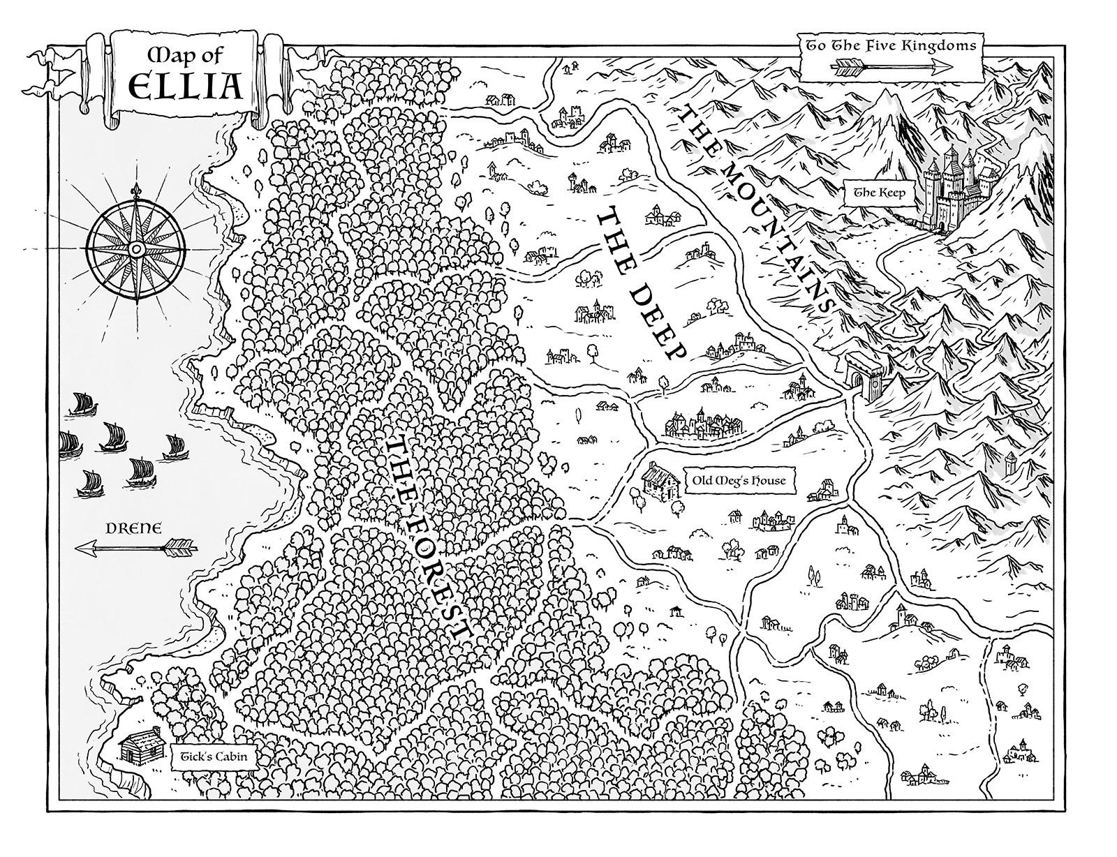
I love a book with a map so it's always a pleasure to draw them!
I've also drawn maps for civic projects, private developments and TV documentaries. You can see a few of them below.
From Small Wonder by Ross Montgomery
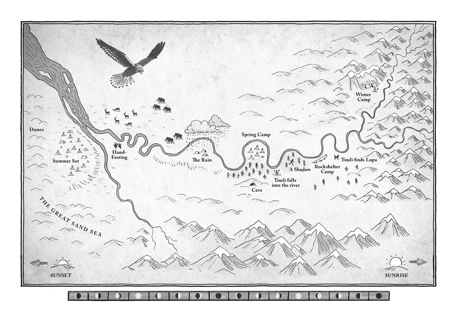
From Wolf Road by Alice Roberts
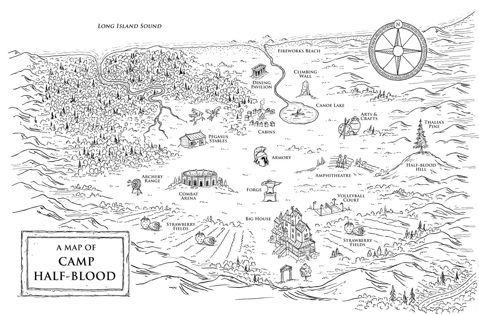
From the Percy Jackson series by Rick Riordan
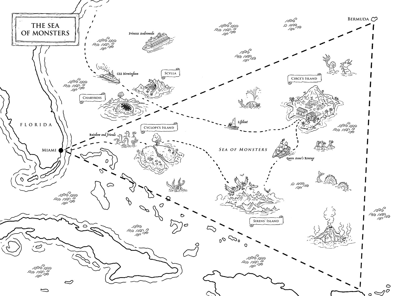
From the Percy Jackson series by Rick Riordan
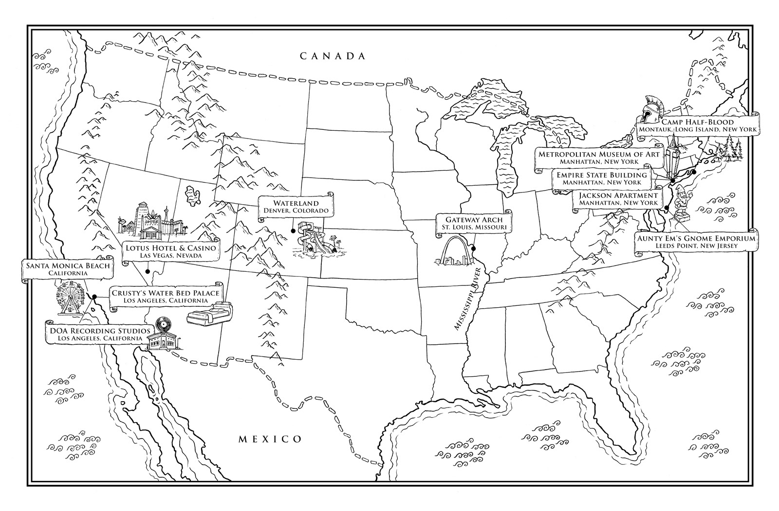
From the Percy Jackson series by Rick Riordan
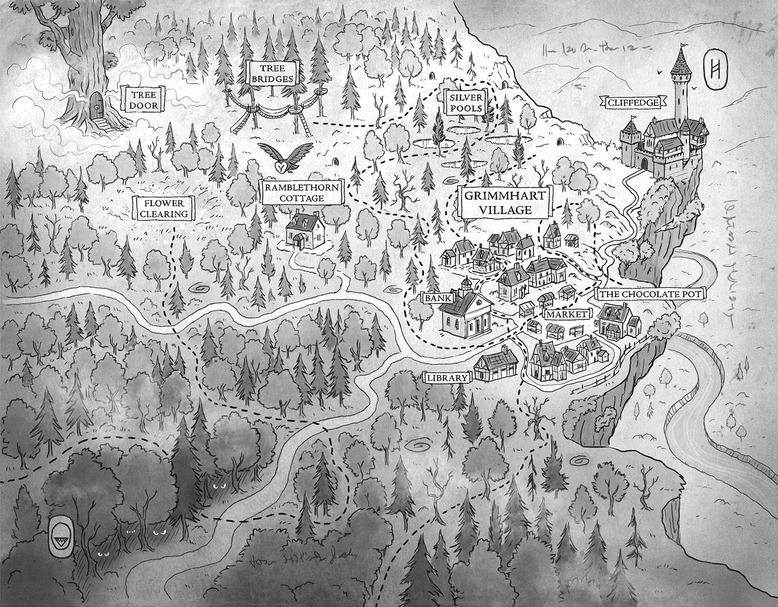
From Forest of Forbidden Magic by Eve Wersocki Morris
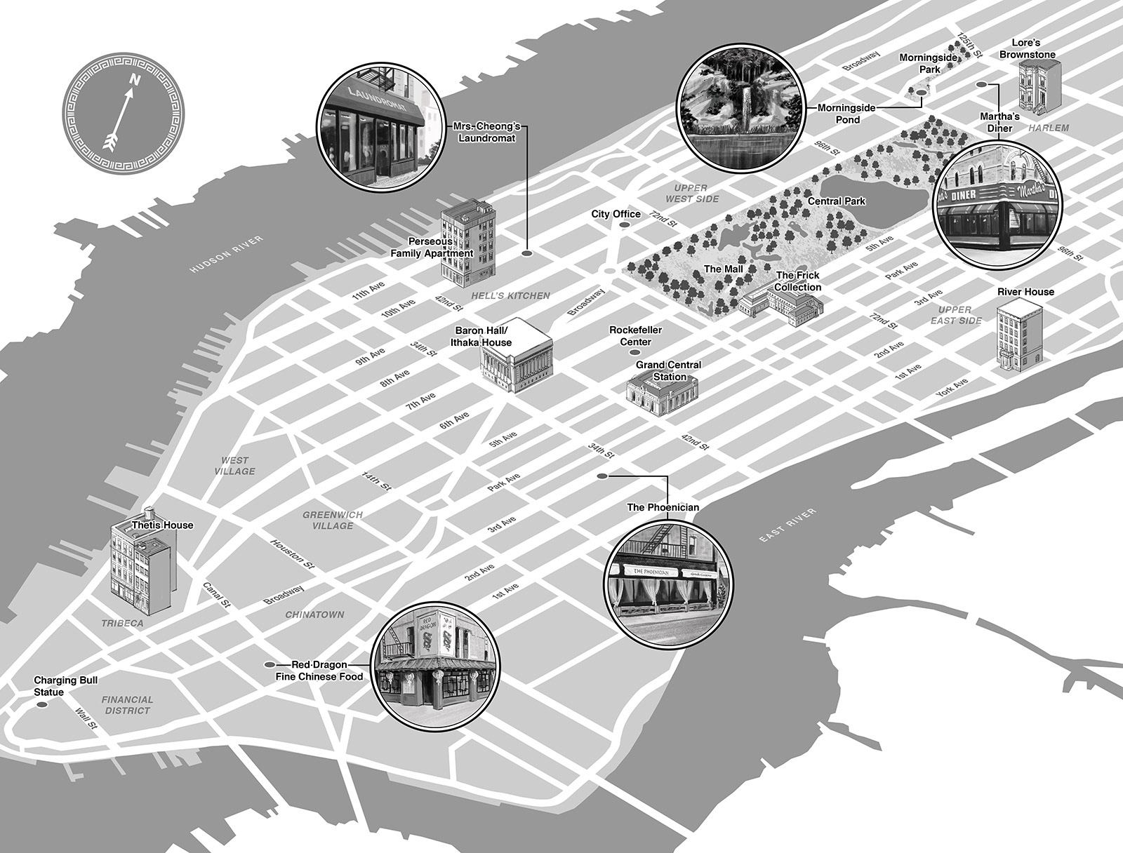
From The Beast, the Queen, and the Lost Knight by Alexandria Rogers
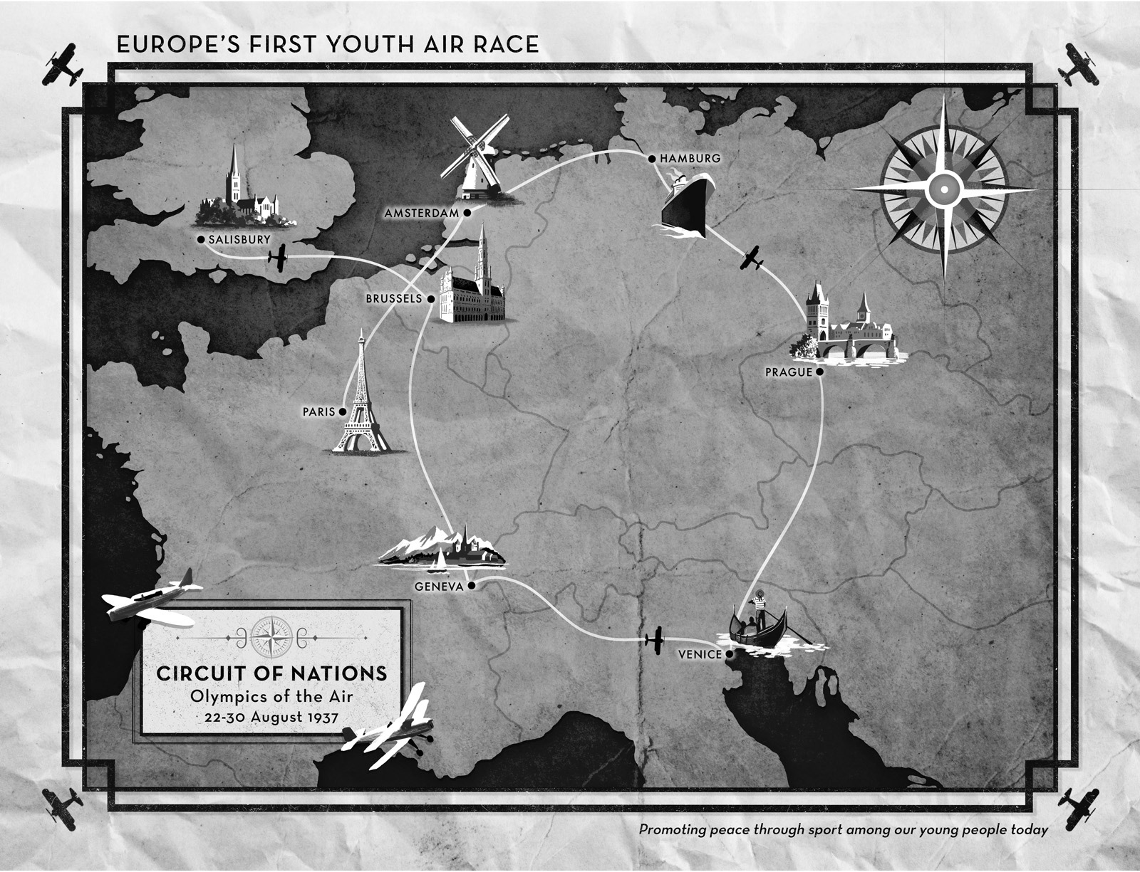
From Stateless by Elizabeth Wein
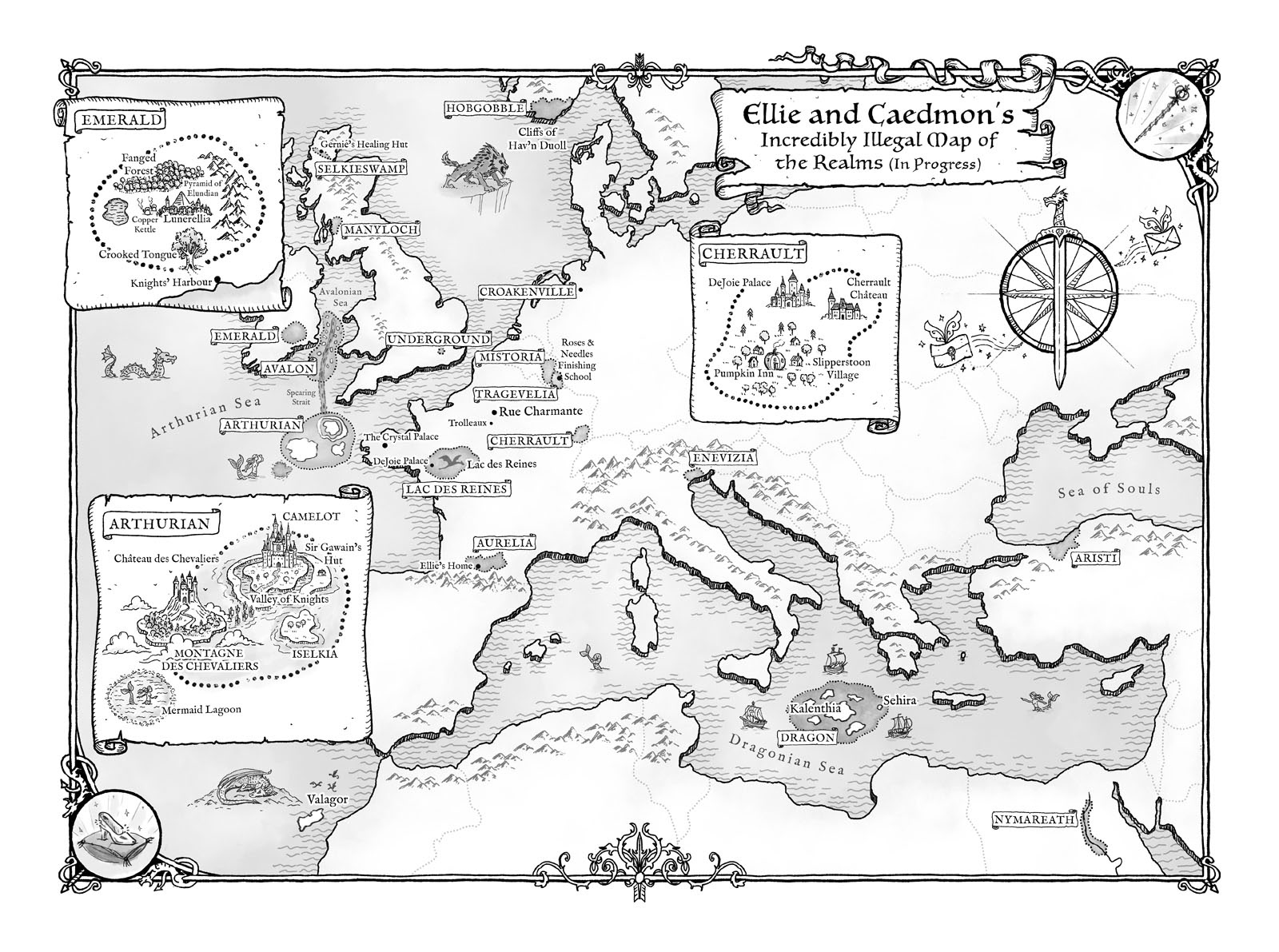
From Lore by Alexandra Bracken
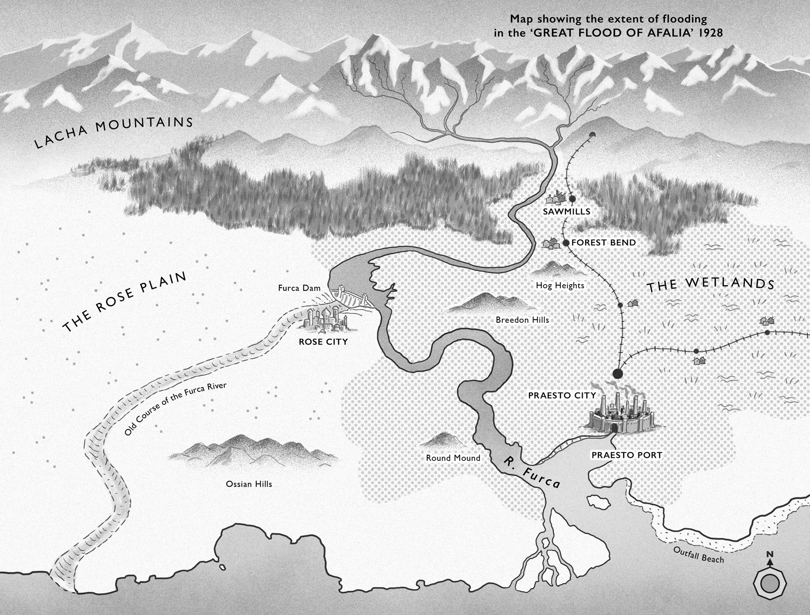
From The Supreme Lie by Geraldine McCaughrean
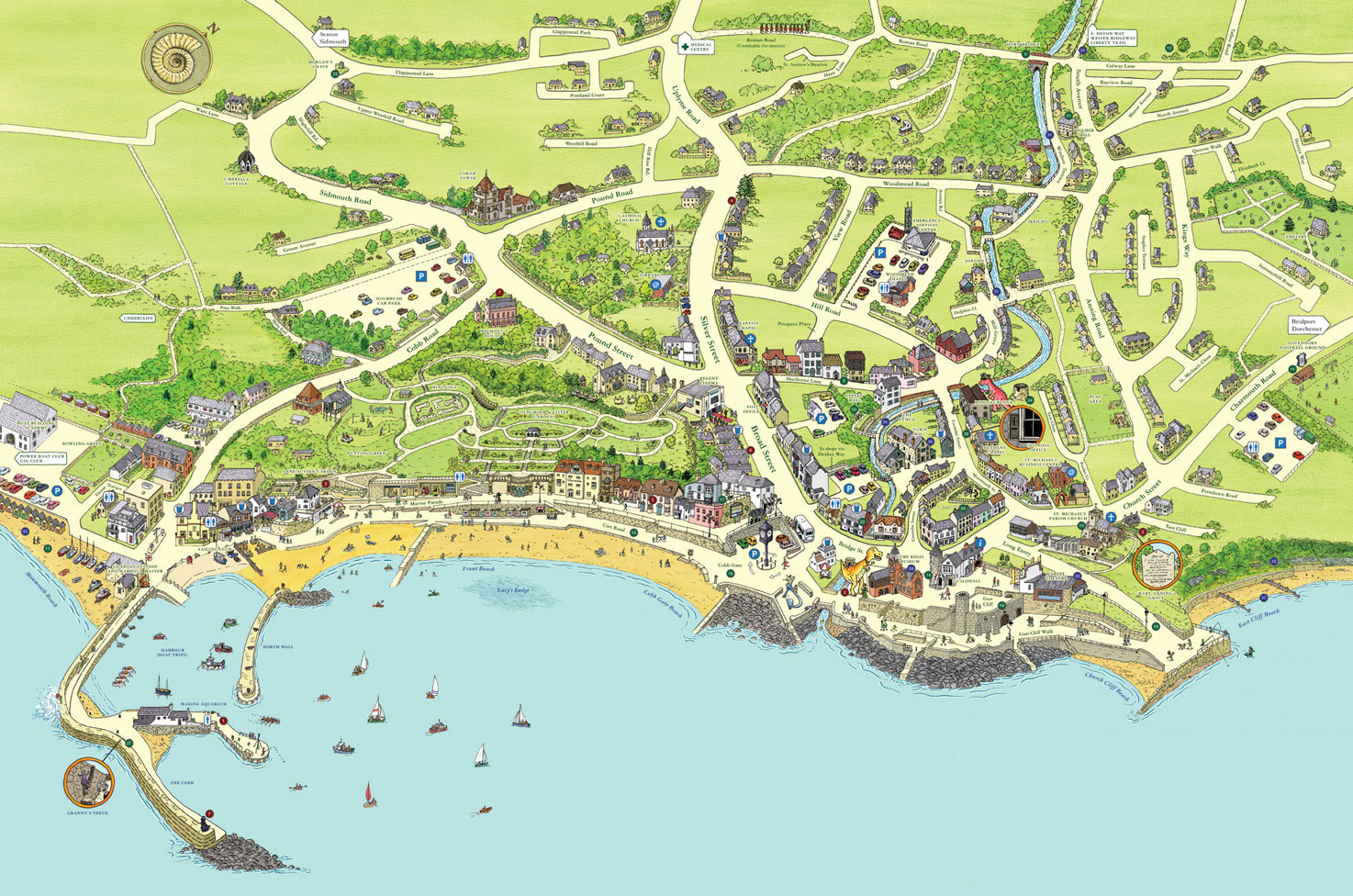
Lyme Regis
This six foot by four foot public artwork hangs prominently on the seafront and is also accessible from a touch screen information point. The map is available as a fold-up tourist guide with a colour-coded key, detailing the many amenities, curiosities and attractions of this pretty seaside town, famous for its fossils.
The Lyme Regis map features in A Map of the World published by Gestalten: 'Contemporary maps in line with the zeitgeist by today’s most original and sought-after designers, illustrators, and mapmakers.'
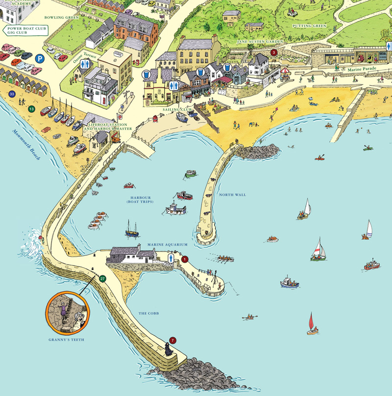
Lyme Regis, harbour - detail
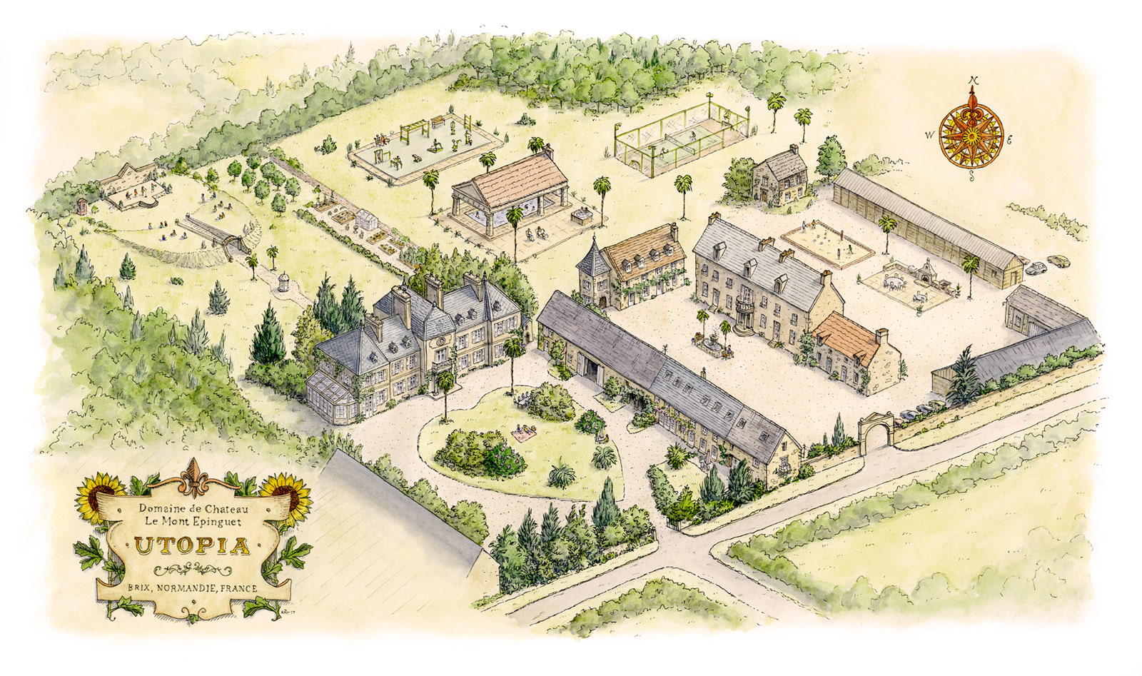
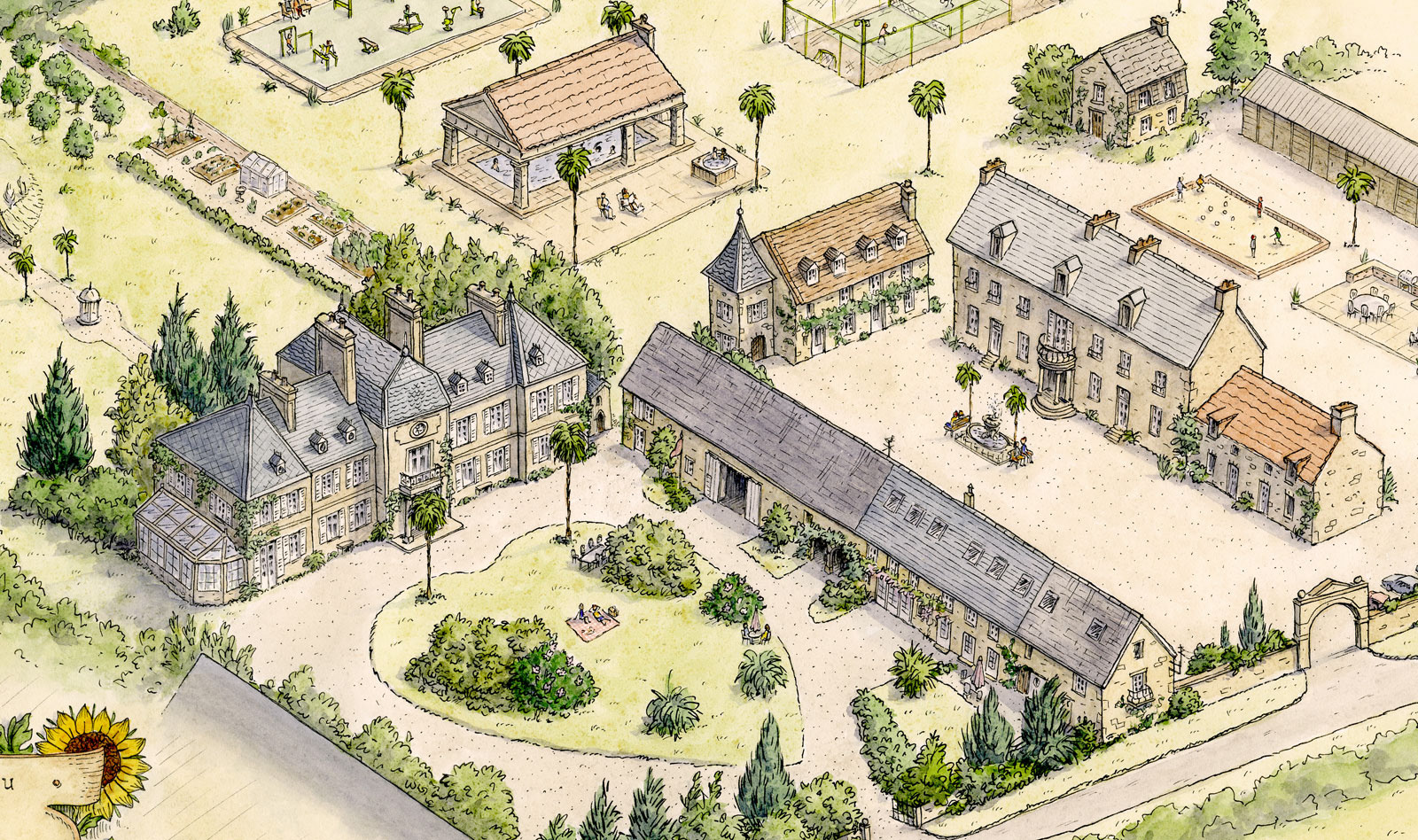
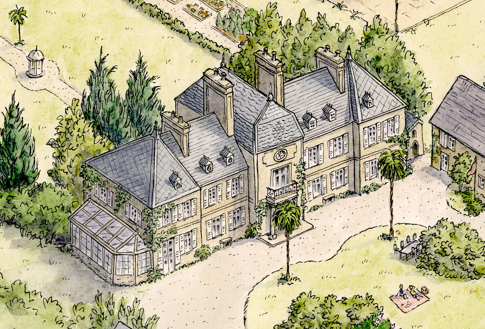
'Utopia' - Chateau Le Mont Epinguet
Chateau Le Mont Epinguet is a beautiful 18th century chateau. As well as being a family home, it offers informal holiday accommodation and hosts various celebrations and arts events. The owners have exciting plans to develop the extensive site, which I've helped them to visualise.
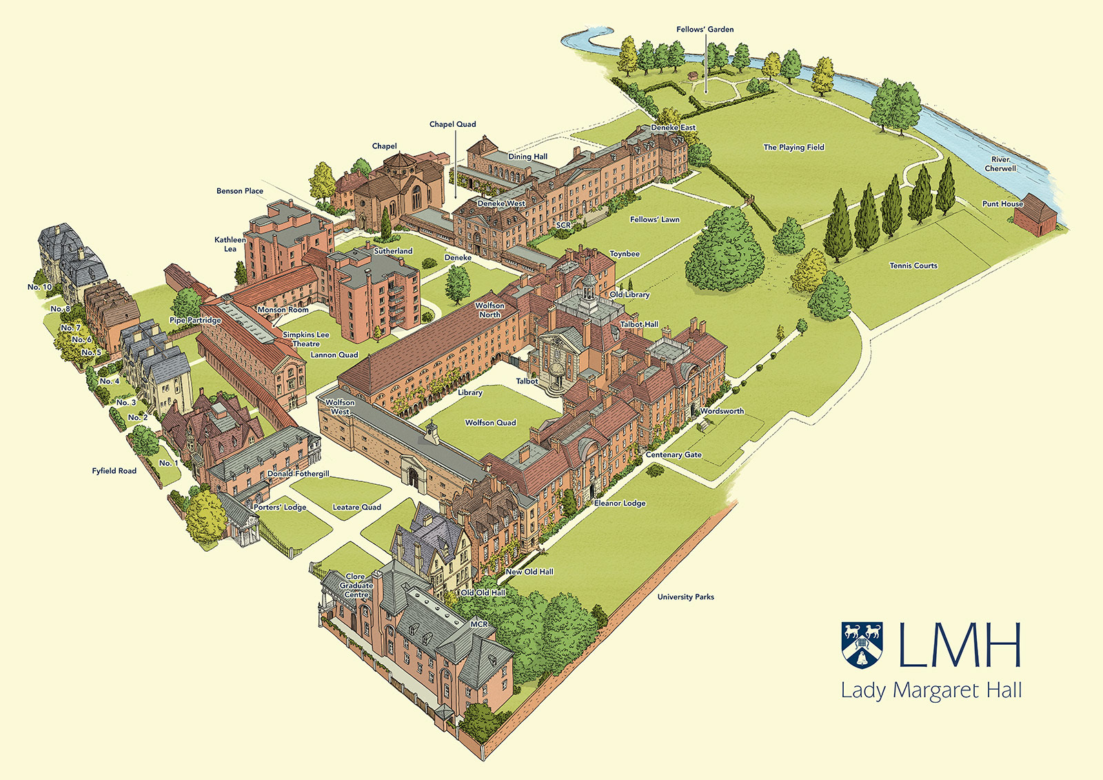
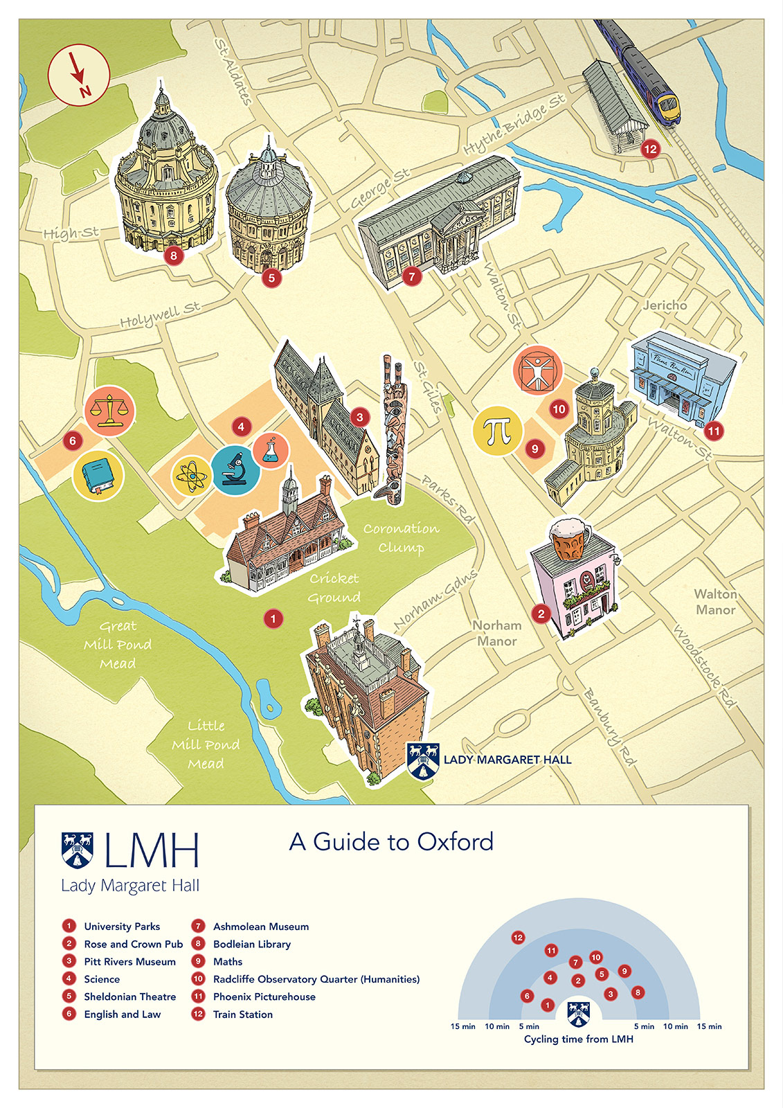
Oxford - Lady Margaret Hall
These maps were commissioned by the Oxford University college, Lady Margaret Hall. They required an isometric map of the college, including recently opened new buildings, as a guide for students to the somewhat complex layout of the campus. I also created a map of oxford, showing some key landmarks and attractions in relation to the college.